


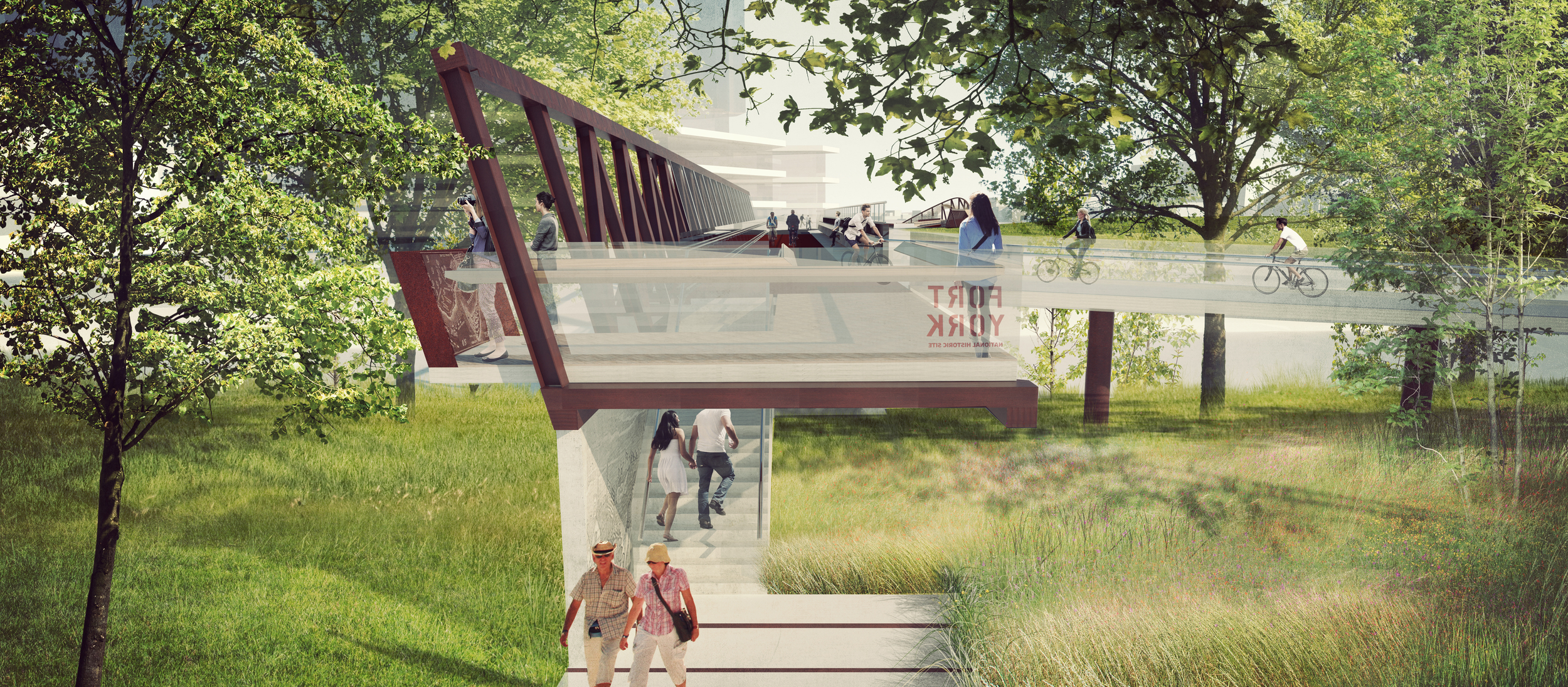


PUBLIC WORK’s design proposal creates a 500m civic connection from Wellington Street to the new Fort York Visitor Centre that choreographs views and marks distinctive public places along the way.
Employer: PUBLIC WORK Office for Urban Design & Landscape Architecture
Role: Concept Design, Visualization + 3D, Project Coordination
Location: Toronto, Ontario
Date: 2015
Status: Invited Competition (Finalist)
Project Team: PUBLIC WORK Office for Urban Design and Landscape Architecture with Ellis Don, Architecture49 + WSP
All images and adapted text property of PUBLIC WORK Office for Urban Design and Landscape Architecture
Published: Urban Toronto
The new bridge sequence connects historic green spaces and important bike routes to create a clear path over the rail yards.
The proposal combines 2 common rail bridge typologies to reference both the existing bridges in the area and also to create a new sequence of views through the site.
Experienced as an integrated sequence rather than two isolated bridge spans, the bridges and landings are seamlessly woven with the landscape approach to create a memorable journey which capture a sense of arrival and renewed perspective of this dramatically changing part of the city.
With the combination of bridges, landings and landscape approaches, this proposal provides a model for investment in civic infrastructure that provides more than just bridges; but also much needed park and public spaces for the growing city.
The bridge’s landing on the Garrison Commons provides an opportunity to commemorate the historic founding landscape of Toronto as a city.
Winding from Stanley Park towards the 1st bridge, the experience of a grand view towards the city is complemented by a naturalized native landscape & covered pavilion.
Connection from the north edge & approach across the new Garrison Point development and on towards the Garrison Commons & The Bentway.