

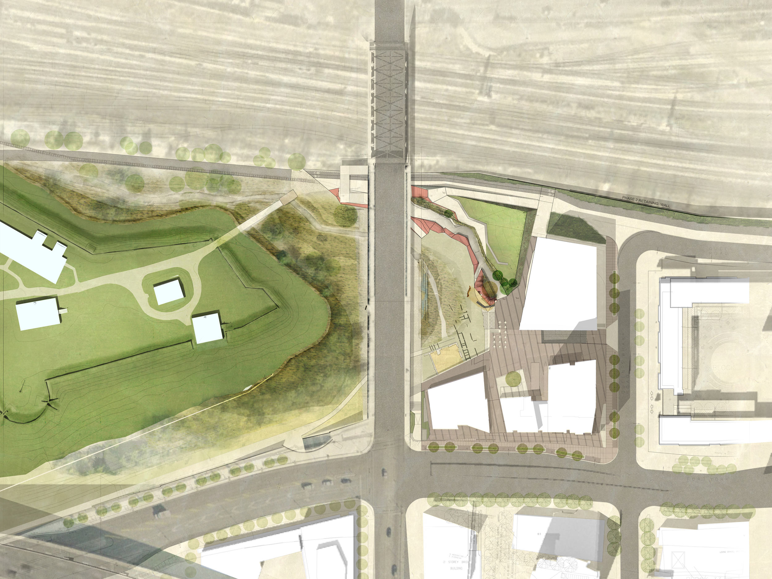
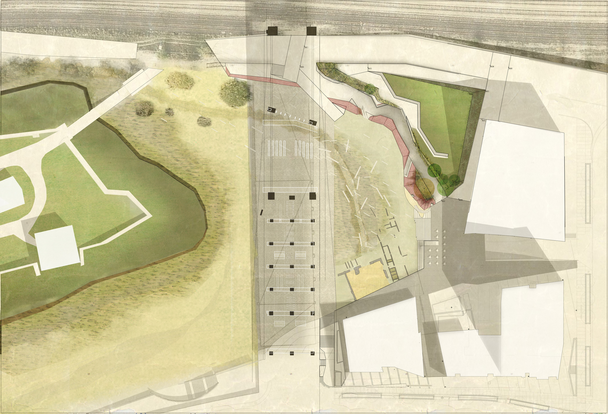


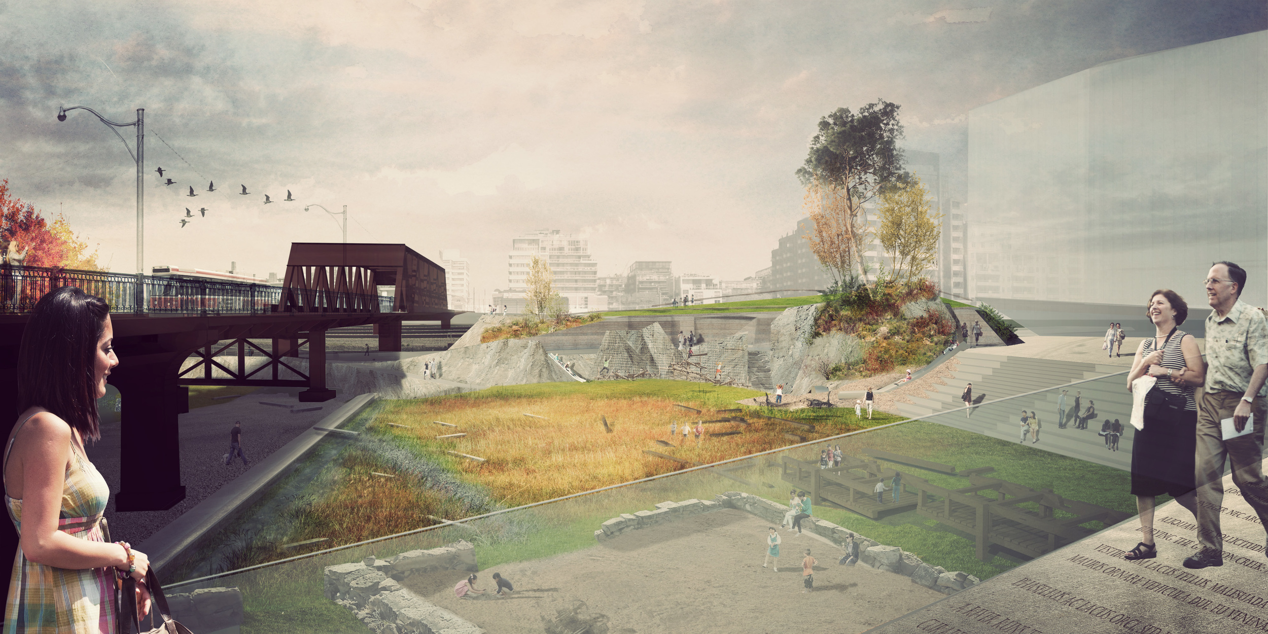


Mouth of the Creek Park is a 1.3 acre park planned for Toronto's downtown Fort York district.
Restoring the landscape to its original shape as a promontory opposite Fort York and separated in the lowlands by the Garrison Creek, the park integrates history and landscape to create a multi-use public space. With an open view towards Fort York under the Bathurst St. Bridge, the area under the bridge is activated as an artistic zone for installations. Meadow grasses in the marshy lowlands provide habitat for urban wildlife and encourages rainwater filtration.
The park is a compact, yet highly programmable urban public space amidst the surrounding development.
Employer: PUBLIC WORK
Role: Visualization & 3D modelling
Year: 2013-Current
Status: In development
Location: Toronto, Ontario
Project Team: Marc Ryan, Gerardo Paez, Chester Rennie & with ERA Architects
All images + text are property of PUBLIC WORK Office for Urban Design & Landscape Architecture
The current location of the park sits directly across from the historic Fort York Garrison, on a promontory overlooking Lake Ontario.